Hua, A.K. (2015). Adaptation and mitigation towards monsoon floods in Kota Bharu, Kelantan. USA: Lulu Press, Inc.
PAGE COVER
APPRECIATION
ABSTRACT
CONTENTS
CHAPTER 1 INTRODUCTION TO ADAPTATION AND MITIGATION TOWARDS MONSOON FLOODS IN KOTA BHARU, KELANTAN
CHAPTER 2 MONSOON FLOODS IN KOTA BHARU, KELANTAN
CHAPTER 3 THE BACKGROUND OF KOTA BHARU, KELANTAN
CHAPTER 4 CASE STUDY: ADAPTATION AND MITIGATION TOWARDS MONSOON FLOODS IN KOTA BHARU, KELANTAN
CHAPTER 5 ANALYSIS OF ADAPTATION AND MITIGATION TOWARDS MONSOON FLOODS IN KOTA BHARU, KELANTAN
CHAPTER 6 FINDINGS, DISCUSSION AND CONCLUSION
BIBLIOGRAPHY
APPRECIATION
Firstly, I am very grateful to Buddhist, for His bounty has given me the strength to finish up my research study. With his permission, I can fulfill some of the requirement for the Bachelor of Degree in Science Geography.
Appreciation and gratitude to YB Dato’ Dr Azizan Hj. Abu Samah, as my supervisors who advice, assist, guide, and contribute his ideas throughout this research project. For all his guidance and efforts in this research study will always be memories forever.
I would like to thanks the staff of Department of Geography, Mrs Hasimah and other staffs, for the assistance provided. Indeed, the assistance provided by the parties involved have been easy for me to finish up my research study and report.
Special thanks go to my family, teammates, and friends, who always give moral support and encouragement, as well as those involved directly or indirectly through this research study and report. With the support and encouragement, it has given me the strength and confidence to continue to strive to complete the research study and report.
Lastly, I would like to take this opportunity to say ‘thank you’ again to all those involved for their contributions and helps, so that I can finish up my research study and report. Indeed, the teaching of Buddhist stated that;
‘Every Karma in action of good and bad will result the positive and negative impacts’
-Ang Kean Hua-
-Ang Kean Hua-
ABSTRACT
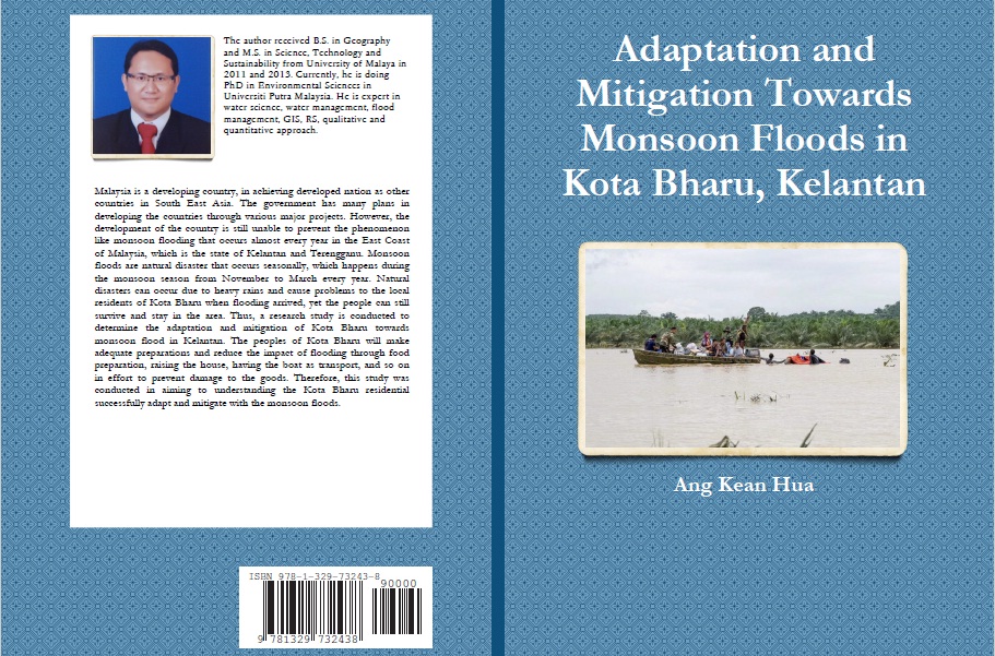
Malaysia is a developing country, in achieving developed nation as other countries in South East Asia. The government has many plans in developing the countries through various major projects. However, the development of the country is still unable to prevent the phenomenon like monsoon flooding that occurs almost every year in the East Coast of Malaysia, which is the state of Kelantan and Terengganu. Monsoon floods are natural disaster that occurs seasonally, which happens during the monsoon season from November to March every year. Natural disasters can occur due to heavy rains and cause problems to the local residents of Kota Bharu when flooding arrived, yet the people can still survive and stay in the area. Thus, a research study is conducted to determine the adaptation and mitigation of Kota Bharu towards monsoon flood in Kelantan. The peoples of Kota Bharu will make adequate preparations and reduce the impact of flooding through food preparation, raising the house, having the boat as transport, and so on in effort to prevent damage to the goods. Therefore, this study was conducted in aiming to understanding the Kota Bharu residential successfully adapt and mitigate with the monsoon floods.
CONTENTS
CHAPTER 1 INTRODUCTION TO ADAPTATION AND MITIGATION TOWARDS
MONSOON FLOODS IN KOTA BHARU, KELANTAN
1.1 Introduction
1.2 Problem Statement
1.3 Research Interest
1.4 Objective of Study
1.5 Methodology of Study
1.6 Organization Report
1.7 Research Problems
1.8 Conclusion
CHAPTER 2 MONSOON FLOODS IN KOTA BHARU, KELANTAN
2.1 Introduction
2.2 Literature Review on Monsoon Floods in Kota Bharu, Kelantan
2.3 Conclusion
CHAPTER 3 THE BACKGROUND OF KOTA BHARU, KELANTAN
3.1 Introduction
3.2 Background of Kelantan State
3.3 Background of Kota Bharu
3.3.1 Physical Characteristic of Kota Bharu
3.3.1.1 Location
3.3.1.2 Climate
3.3.1.3 Drainage System
3.3.1.4 Hydrology
3.3.1.5 Land Used
3.3.2 Human Characteristic of Kota Bharu
3.3.2.1 Total Population
3.3.2.2 Activities and Urban Development
3.3.2.3 Service and Facilities Infrastructure
3.3.2.4 Flood-Prone Areas
3.4 Conclusion
CHAPTER 4 CASE STUDY: ADAPTATION AND MITIGATION TOWARDS
MONSOON FLOODS IN KOTA BHARU, KELANTAN
4.1 Introduction
4.2 Methodology Framework
4.3 Data Collection Methods
4.3.1 Primary Data
4.3.1.1 Questionnaire Method
4.3.1.2 Sampling Method
4.3.1.3 Interview Method
4.3.1.4 Observation Method
4.3.2 Secondary Data
4.3.2.1 Library Study
4.3.2.2 Information From The Internet
4.3.2.3 Data and Information From Department
4.4 Analysis Data Method
4.5 Conclusion
CHAPTER 5 ANALYSIS OF ADAPTATION AND MITIGATION TOWARDS
MONSOON FLOODS IN KOTA BHARU, KELANTAN
5.1 Introduction
5.2 Analysis of Respondent Biodata
5.3 Analysis Internal Factors of Respondent
5.3.1 Analysis Respondent in Adapting To Flood
5.3.2 Analysis Respondent in Mitigation To Flood
5.4 Analysis External Factors of Respondent
5.4.1 Analysis Government through Physical in Reducing Flood
5.4.2 Analysis Government through Humanity in Reducing Flood
5.5 Conclusion
CHAPTER 6 FINDINGS, DISCUSSION AND CONCLUSION
6.1 Introduction
6.2 Research Finding and Discussion
6.3 Conclusion
BIBLIOGRAPHY
CHAPTER 1 INTRODUCTION TO ADAPTATION AND MITIGATION TOWARDS MONSOON FLOODS IN KOTA BHARU, KELANTAN
1.1 Introduction
Malaysia is a developing country, in achieving developed nation with other countries like Singapore, Brunei, and others. The government has many plans in developing countries through various major projects. However, the development of the country is still unable to prevent disaster such as monsoon floods that suffered the people who live in the East cost of Peninsular Malaysia, which is the state of Kelantan and Terengganu. Monsoon floods are natural disaster that occurs as a result of the Earth circulation on its axis and results in different wind movements happen, where the winds known as North-East monsoon contains a lot of water vapor moves from high pressure areas to low pressure areas.
Generally, monsoon floods occur seasonally, which happens during the monsoon season from November until March. Flood can be caused by some specific factors and most common is the continuously raining without stopping cause flood. Rain water moves on the Earth’s surface known as runoff (or surface water runoff), which flows from the high area to low area. Surface water runoff will flow into river before channeled into sea. However, large amount of water flow into river drastically causing the water to overflow from river. Therefore, this will result to monsoon floods to occur.
1.2 Problem Statement
Every year, monsoon floods occurred in the state of Kelantan, especially Kota Bharu district causing local residents suffered from the natural disaster. These situations had cause the people to expose and experienced the monsoon floods. According to the location of geography and population, the amounts for local residents are increase yearly even the percentage of damage by natural disaster is increased. Again, this condition leading to benefits of monsoon floods every time the hazard is hit the district. So, researcher is very interested to carry out study on local resident to adapt and mitigate with the monsoon floods. Through observation research in Kota Bharu district, most of the local residents are lives near the river (which known as Kelantan River) due to accessible of water resources for daily activities. Therefore, the information provided by local residents will be more accurate and precise because the peoples will have higher percentage of experience towards monsoon floods.
1.3 Importance of Research Study
The researcher hope that this research study will provide benefits to society, such as;
-Provide a clear condition of monsoon floods hazard hit in Kota Bharu.
-Provide information on local residents in adapt and mitigate towards monsoon floods by reduce the impact and transform into benefits for continued surviving.
-Understanding the socio-economic impact in terms of the ability of local residents to flooding at Kota Bharu.
1.4 Research Objective
The objective of research study can be categorized into several, namely;
-To determine local residents of Kota Bharu in adaptation through internal factors towards monsoon floods.
-To determine local residents of Kota Bharu in mitigation through internal factors towards monsoon floods.
-To determine the government in reducing the monsoon floods through external factors.
1.5 Research Methodology
In general, research study can be divided into three stages, namely early or initial stage, data collection stage, and analysis data and discussion stage;
Early or Initial Stage
Firstly, researcher has to choose a suitable topic for research study and learn about the background of the selected study area. Once the research topic has been specified, then the next step is to identify the goals, objectives, and justification of the study.
Data Collection Stage
In this stage, researcher will need to carry out some activities like searching data or information in order to strengthen the research study related with problem statement and research objective. The data can be divided into two types, namely primary data and secondary data. Primary data can be involved with observations, interviews, statistics, and so on, which required local residents to provide information for the research study. Meanwhile, secondary data consists of data, transcript, or report that already prepared by the federal government, state government, and others information from journal articles, books, thesis, magazines, and others on monsoon floods. After data is successfully collected, the data will be presented to supervisors for evaluate the reliability.
Analysis Data and Discussion Stage
This stage will involve with analysis data and result discussion. After the data is ready, it will be key-in into computer through Statistical Package for Social Science (SPSS) version 14. The data will be analysis based on the requirement of objective study, for example descriptive analysis, correlation analysis, chi-square analysis, regression analysis, factor analysis, and so on. In this study, the analysis involve is descriptive analysis, where demographic profile, adaptation and mitigation of local resident in internal factors, and involvement of government in reduce monsoon floods through external factors will be explain and discuss to provide new information.
1.6 Organization Report
After conducting the research study, a research report will be prepared and it’s can be divided into six chapters, which is;
Chapter One
The first chapter will describe in general about the background of floods during the monsoon floods season, problem statement, important of research study, research objective, research methodology, and conclusion. In short, this chapter is dedicated to giving the initial impression to the readers.
Chapter Two
This chapter explains the study of literature (or known as literature review) by researcher. This chapter contains a number of previous studies that were chosen and used as a reference by researcher.
Chapter Three
Third chapter explains the background of the study area, namely Kota Bharu, Kelantan. At the same time, the study will described about the physical characteristics, humanity and cultural characteristics.
Chapter Four
In this chapter, researcher will explain more detail about collecting data through using questionnaire. Sampling area and sample size will also be highlighted in chapter four.
Chapter Five
Chapter five is the most important in this research study, where all analysis will take places. Researcher will analyze and explain the result for demographic profile, adaptation and mitigation of local resident in internal factors, and involvement of government in reduce monsoon floods through external factors.
Chapter Six
Researcher will make several suggestions on how local residents of Kota Bharu to cope with the flooding for every time the monsoon floods are hit. Generally, this chapter will summarize and conclude every chapter.
1.7 Research Problems
This research study focuses on the investigating of the flood which follows the monsoon season and its relationship with local residents of Kota Bharu. The study only focused on the city of Kota Bharu and targeted respondents are focused on local residents that live near to Kelantan River, having simple house, and so on.
The main problem is the people of Kota Bharu quite difficult to cooperate, especially in obtaining the information through questionnaire that needed by researcher. This is because when researcher trying to receive or getting the information from local resident, they are trying to avoid by giving a lot of reason, for example very busy.
The cost in getting the data and resources is expensive because most of the data are needed to obtain from government department and private agencies, for example maps, land used data, population data, and others. So, the resources provided will require extremely high expenses even the research study is intended for academic purposes.
The difficulties in analyzing the questionnaire as some survey that answered by respondents are incorrect due to time constraints, educational problems, and others. Since researcher are difficult to have grant, so the questionnaire are only distributed by researcher alone and this will required some time to achieve the objective of the sample size.
Cooperate provided by government official in connection with the data required by researcher is difficult. This is because the data requested by certain departments will take some time and this will delay the process to review data. At the same time, the government department providing the data are also not complete and researcher have to looking for other method to get the data.
1.8 Conclusion
This chapter contains the introduction, problem statement, important of research study, research objectives, research methodology, organization report, and research problems. In general, the introduction explain about the monsoon floods that hit in Kota Bharu, the statement describes about problems that need to be facing by the people of Kota Bharu when monsoon floods hit the area, the objectives of the study describes the local residents of Kota Bharu adapt and mitigate with the monsoon floods, and the problems that researcher need to overcome when trying to collect the data from local resident. Lastly, researcher is very hope that the process to collect data, analyzes data, and providing the result with new information can be undergo smoothly.
CHAPTER 2 MONSOON FLOODS IN KOTA BHARU, KELANTAN
2.1 Introduction
Previous study about monsoon floods is important to support this research study. In other words, researcher had made some readings and research about monsoon floods before conduct this monsoon floods study, especially towards local residents in adapt and mitigate with the flood. Flooding is a natural disaster that occurs in the human environment. Floods can be associated with river flooding, estuaries flooding, coastal flooding, muddy floods, and other affects that can cause flooding. However, the floods that occurred in this country is river flooding, where these disaster can be divided into two, namely fast flood and slow flood. In other words, fast flood can be described as flash floods, which is frequently occurs in urban areas. This flood will happen in very short time, which is 3 to 6 hours. Meanwhile, slow flood can be classified as monsoon floods, which is occurs in a large areas like Kelantan state or Terengganu state. Basically, this flood will happen in a very long time period like 1 to 3 months.
2.2 Literature Review on Monsoon Floods in Kota Bharu, Kelantan
Monsoon floods are natural hazard that occur in Malaysia including Kelantan, Terengganu, Sabah and Sarawak, and it’s consider as slow flood. Generally, slow flood or flooding happen in longer period of time because of the heavy rain or melting snow that continuously generate surface runoff in high percentage and exceeds the capacity of a river channel. Among the factors that leading to heavier rain is monsoon wind and storm that bring the slow flood to occur. Meanwhile, fast flood or a quickly flooding and in a short period of time is happen due to low surface area and encourage water retention easily occur and result in flash floods. Among the factors to cause this occurrence of flash floods is convective precipitation (intense thunderstorm) or sudden release of water that can be associated with the dam.
According to a study conducted by Geis and Steeves (1980), emphasized that flood occur naturally and create a problem when associated with human life. They made a study of the hydrological cycle is a cycle that circulates water from the oceans into atmosphere, land and back to the ocean through evaporation, precipitation, surface runoff and streams process. Hydrological cycle leading to the occurrence of flood such as flash floods, monsoon floods, coastal floods, and so on. In addition, they also pointed out that the flood can lead to a lot of problems or troubles to human as a result of the people that build settlements in areas prone to flooding impacts, and lead to various issues like physical damage, mentality disturbance, infectious diseases and others.
On the other hands, a book entitled ‘Flood, A Geographical Perspective’, written by Roy Ward (2002), stated that flooding is a disaster that can occur in various situations whether under the basin or coastal zone, and producing a variety of conditions that can increase the flood to happen more often (for example decomposition riverside). However, according to Chow (1956), most of the floods are closely linked to river flooding and this describes the definition of flooding, where the water flow and quantity is higher will weaken the canal and increase the surface water runoff. Nevertheless, the definition of flooding is being critic by Rostvedt (1968), where he said that flood can occur due to the large amounts of water and strong water flow causing the water level exceeds the normal level of the river. So, flood could happen due to the water level or ‘discharge’ is higher than the flood level or ‘flood discharge’. Therefore, this definition are more appropriate to defined the flood disaster especially involve with river.
Monsoon floods occur as a result of differences in air pressure that exists in different areas. During the month of November to March or in winter, sunlight is falling on the Southern Hemisphere and forms a low pressure area in Australia, while in the Northern Hemisphere also form a high area in Central Asia. Due to radiation and convection cooling of cold air continuously create a layer of very cold air and a stable near Siberia and in the North China with movements in haling in the Southwest by the Tibetan Plateau. This increases the power of ‘Baroklinik zone’ between the continental cold air mass and the mass of hot air to the South Tropical. Therefore, a gap is in the middle latitude increases ‘anticyclogenesis’ near Central China and ‘cyclogenesis’ occurs near the East China Sea (Ooi et al, 2011). Bonding surface pressure gradient across the waters of the East China initiates a cold surges over the South China Sea. Cool exterior act with equatorial gap (near-equatorial trough) to generate additional convection and associated with periods of heavy rain in the peninsular and the surrounding (Ooi et al, 2011). So, this situation has caused flood resulting from heavy rain brought by the Northeast monsoon winds. Heavy rains in the states of Kelantan, Terengganu, and Pahang are more likely to get flooding. However, people living in the flood plain can still adapt, but also at the same time reduce the impact of flooding with various methods that being performed.
Flood will bring various disadvantages and advantages to the environment and the people. A research conducted by Misha et al (2010), where the study concentrate on the relationship between humans and the surrounding area that they live and make preparation for the flood. In the everyday life, there are various disasters occur naturally (example earthquake, flood, hurricanes, typhoons, tsunamis, etc.) and affect the human activities and facilities (example buildings, bridges, highway collapse, etc.) will have potentially to destroy or damage the physical environment, and spreading diseases to human live that may cause death (Lindell et al, 2006). However, a natural disaster will happen anywhere and anytime, and it’s unpredictable. So, to avoid the flood that continues to occur, focusing on the methods of hazard and risk management, avoid from living near areas prone to flood, construct building at higher position, adopt the mitigation effects, and provide information and warning system in order to be in a ready state for any emergency cases (Lewis & Kelman, 2009).
A research done by Brammer (1990) entitled ‘Flood in Bangladesh: Flood Mitigation and Environmental Aspects’ stated that the people of Bangladesh are facing various problems related to political, economic, and social due to the flood that every time hit these areas. So, he conducted a study on how to cope with the flood disaster that hit the people of Bangladesh through several methods like ‘Flood Action Plan’ and ‘Planning Consideration’, which become main method of flood mitigation plan, followed by other methods such as excessive water storage in the upper basin of flood storage areas, and small-scale irrigation strategy. As for the environmental aspects, the flooding will lead to a corrosive process and settling sediments transported from upstream to downstream. This situation will lead to the probability of flood are likely to occur. In addition, the sediments that transported from upstream and deposited in downstream will cause the area to become fertile after the flood and this will promote the agricultural activities for the local resident. So, the percentage rate that prone to floods is increased because local resident will be living near to the flooded areas, just to receive the benefits like water resources and carry out agricultural activities.
Next, Chan and Parker (1996) carry out a research study on ‘Dynamic Response to Flood Hazard Factors in Peninsular Malaysia’, explain about the flooded area is suitable for rice cultivation activities, fishing, and the village. Activities village in question is related to the physical house, which rising the house by building the pillars, where this method can reduce the inflow flood into the house and reduce the destruction caused by the floods. In addition, the results of interviews with people about the adjustments to the floods, where most of the poorer families are more prepared to face the floods by providing boat which act as main transport, transfer the important document to higher areas, move the vehicle to a safer place, prepare can food before flood arrive, switching off the main electrical during floods, and always be alert about the news of weather forecast. However, another study proved that the rapid development and extensive land use will cause flooding easily occurs (Mitchell, 2010). The flood will lead to the destruction of property, crops and livestock, and so on. So, as an alternative to prevent flood occurs, an adaptation and mitigation of floods needs to be done and the study of "vulnerability" of flooding should be established so that local residents can save the important documents and be aware of how to manage the flood disaster.
Another related with flood that reviewed by researcher are Brown & Damery (2002) entitled "Managing Flood Risk in the UK: Towards an Integration of Social and Technical Perspectives" saying that the study of flooding in the UK, which led to the damage and create natural disasters (example Newson 1975; Purseglove 1988) as a result of the tides and river flow (eg Law et al., 1998; Lamb 1991). Thus, their research is to produce an institutional framework for managing floods in the UK, the assessment of the floods, and a complete analysis of the destruction's issue due to the flood. The framework for managing floods in the UK carried out by producing the construction and maintenance of river and coastal flooding react as the defense, and identify areas of flooding through the construction of "Indicative floodplain Maps". The framework is generated through some analysis of the flood and can reduce flooding in the area of the incident involving the river. Meanwhile, the evaluation of flood disaster is also having various methods to overcome the flood such as hazard mapping, problem in flood mapping in training, and within the range of disaster areas.
‘Flood Hazard Management in Britain: A Changing Scene’ journal article written by Rowsell and Handmer (1988), stated that the people of Britain who live in flood-prone areas will face the problem of flooding as a result of the terrain is relatively low. However, other reason to cause the people in facing the flood is due to the government withdraws the grant of residents and they had to move out and have to live close to the river. So, the population living near the river is estimated to grow larger. In order to reduce the suffering of the British population as a result of flooding, several studies have been conducted and several methods can be applied by the British people in the daily life. This include disaster mitigation in the long term through control of development in flood areas, the existence of flood mitigation structures toward natural disaster and flood warning system that can help the people during the floods. In this situation, whether the government, the engineer, environmental management expert, and the geographer will play an important role to reduce the floods.
Besides that, a research done by Zaman (1993), with an interesting study entitled ‘River of life: Living with Floods in Bangladesh’, saying that the study of the monsoon floods hit the country of Bangladesh in June and October, where the rains across the valley of the Ganges-Brahmaputra-Meghna, resulting in soil are very fertile by supplying moisture and a fresh mud for thousands of species of plants and the production of eggs fish are available at the time. This situation has shown that floods not only brought harm, but also bring benefits to the people living close to the valley. The impact of damage resulted from flooding are very less due to the thousands of people living in flood plains and are very experience with the monsoon floods, causing the population to adapt to agricultural activities, having the suitable crops, and settled in the floods area for every year. According to geographical background of Bangladesh, the major river systems is flowing from the Bangladesh border, namely the upper India-Himalayas, Nepal, Bhutan, and Tibet, which will affect the environment, economy, and the national of Bangladesh. However, the main cause of flooding led to environmental degradation, where the surface water flow is very rapidly and the water cannot be absorbed into the ground. So, this would cause flooding in low-lying areas prone to occur when water flows from upstream to downstream areas and there are large quantity of water accumulates in the downstream area. However, the villagers in Bangladesh country still practice traditional activities, where one of the project "Protection" carried out by farming. But the project is more on reducing flooding and seeks to avoid the absorption of water into the ground is more effective. This has encouraged more people to migrate to the flooded areas to lead a normal life.
Not only that, a study using "Flood Action Plan" or FAP that emphasizes social and environmental issues, and alleviate flooding problems experienced by local resident in Bangladesh by implement a comprehensive of flood design, water and land management effectively, methods to strengthen preparedness against floods and disaster planning, progress in predicting and early warning system with data sharing between countries that affected by flooding, determination of flood areas, and the involvement of local interest in planning, and operation of flood control and drainage work. Apart from implement the FAP, another project are also carried out which involve with research for all major rivers and areas that affected by flooding, strengthen, connect, and increase the level of river fortification, protecting the central part of main town, rectification the flood warning system, and the use of pilots projects toward the river and flood control techniques that will happen.
Petak (1980) carried out research about ‘Mitigation Strategies’, where his study is about strategies to deal with a disaster when it occurs. In his research is so called as the real purposes of mitigation in a strategy for managing and balancing the reaction and expenses for physical damage resulting from a disaster. Human activities are likely to change the frequency of adverse events that result in an increase or decrease of such events, the effect of changing the size of the area, affected by the exposure of humans or property as a result of the incident, the circumstances that can destroy property by exposure to disasters, speed up or slow down restoration of damaged facilities, and reduce or increase the individual suffering. So, programs or activities through mitigation are urgently needed to reduce the impact of an impending disaster. Mitigation activities are to remove or reduce the likelihood of catastrophic events, or reduce the impact of disasters. In preparation, governments, organizations and individual have to made the development, testing, and concern for human life and reduce hazards. Among the mitigation practices such as the construction of dams to control the quantity of excess water, the physical alteration of drainage system and construction of buildings, build reservoirs to control the excess water, and flood control during emergency situations. In addition, the strategies that can be used is a precautionary methods to control the floods by replanting forest trees, reduce the slope gradient to decrease surface runoff, manage watersheds to reduce soil erosion, forming river basins to reduce sediment and waste traps, and so on. This method is excellent, but there will be lesser-used if applied in Malaysia, especially in the East coast of peninsular because the flood that occurred at Kota Bharu was natural.
The flood disaster is an occurrence or events that happen naturally. This incident that occurs often associated with human life, which would lead to harm and affect the quality of human life. Various studies have been done to reduce the impact of the flood. One of the methods is through "vulnerability" or variables that are associated with flooding. The variables can be defined as a model that produced by various research studies can be used to predict and to control and mitigate the effects of a disaster, especially floods. The study in "vulnerability" by Adger (2006) stated that a lot of research about the method of producing models that fit through the "vulnerability". For the study to achieve a common objective in generate a model based on the "vulnerability", several methods need to be taken into account such as the measurement of "vulnerability" that needs to be focus on human safety and property (including facilities) damage, followed by measurement of risk in a dynamic period, and the ability to measure the distribution of "vulnerability" in within the system of "vulnerability" itself. So, through the research of "vulnerability", a study of a disaster can be measured based on the results of its analysis and can be used as a model to control and reduce the impact of a disaster.
Simultaneously, Messner and Meyer (2005) carried out a research entitled "Flood Damage, Vulnerability and Risk Perception - For Flood Damage Research Challenges", had discovered on how to tackle the problem of flooding through the "vulnerability". A study can be consider as the most successful in reducing the impact of floods and solve the problems through analysis of "vulnerability" are compulsory to involve the study of an assessment and analysis of the impact of flood in the socio-economic development, where the first stage is to analysis the impact of flood by calculate the flood characteristics and the second stage involve with estimates of potential damage and calculate the probability of flooding damage effects.
Thus, this research study is focused on achieving the objectives, which is determine local residents in adapt and mitigate with monsoon floods and determine the government role in reducing the monsoon floods. Again, this study will provide methodological guidance to forecast the impact of flood on human health and the environment, provide guidelines about flooding that can affect the economic through the inflow and outflow of investment, and increase the use of the "vulnerability" model that exists between the relationship of damage and the flood disaster characteristic. Therefore, the study will be the first successful in producing a model that is more effective in controlling and reducing the impact of floods.
2.3 Conclusion
Researcher had several readings and reviews involve with floods and assess on how people living in flood plains can cope with the flood by getting the pros and cons. Although regular floods occur every year, but people are still living in the area and felt that the flood season give benefits through increase the households’ income. To understand more about flood, it is best way for the researcher to face and experiences the flood itself, and the researcher will also interview respondents to get clearer about the monsoon flood.
Having a lot of reading by researcher shows that the people work hard to adapt with the flood and have the efforts to reduce flood even the flood are continuously 'disturbing' their house. In Perkampungan Sungai Keladi, a small area in Kota Bharu, showing that local residents are practice on how to adapt and mitigate with the flooding for every time it hit the area. For example, local residents will prepare the boat to serve as transport during flood and transfer important documents to safety. In addition, local residents will also took the opportunity to conduct appropriate activities such as fishing, playing floodwaters, undergo a small business by having 'a short visit the housing', and so on. Another journals carried out by Zaman (1993) entitled "Rivers of Life: Living with Floods in Bangladesh" and Chan and Parker (1996) in "Dynamic Response to Flood Hazard Factors in Peninsular Malaysia" are having almost the same scenario with local residents in adapt and mitigate in Kota Bharu. Not only that, government intervention through physical repair such as widen the river, broaden the river, and deepen the river is to reduce the impact of flood to occur, for example in scientific research, entitled "Mitigation Strategies". In addition, the government also took an action by introduce a flood zone area and precautionary measures if there are raining heavily, just like a research study conducted by Brown and Damery through its title "Managing Flood Risk in the UK: Towards an Integration of Social and Technical Perspectives ".
CHAPTER 3 THE BACKGROUND OF KOTA BHARU, KELANTAN
3.1 Introduction
Researcher should recognize and understand the study area before carry out the research study. This is because the methodology will involve with the collecting data, sampling area, sample size, and others. At the same time, it is important for researcher to adapt with the situation of before, during and after the monsoon floods hit the Kota Bharu. In this section, the discussion will focus on the background of the state of Kelantan, with concentrated on the physical characteristic and humanity characteristic in Kota Bharu. In general, Kota Bharu is the earliest place to experience the Northeast monsoon wind that brings to the monsoon floods, continued by Terengganu and Pahang. Therefore, a research in Kota Bharu can be consider as the most effective solution towards flood disaster because new information generated will be model of solution to the other areas to cope with the flood.
3.2 Background of Kelantan
The location chosen in this research study is the Kelantan state, which is one of the states in Malaysia with an area of 15,022 km2 with 10 districts as shown in figure 3.1 and table 3.1.
The coordinates of Kelantan is 6°7’31.43” N, 102°14’17.04” E (LatLong Official Portal, 2015), which is located in the Northeast Peninsular Malaysia, facing the South China Sea and bordered with Thailand in north, Terengganu state in east, Pahang state in south, and Perak state in west. Kelantan consists of 10 administrative districts, namely Kota Bharu, Pasir Mas, Tumpat, Pasir Puteh, Bachok, Kuala Krai, Machang, Tanah Merah, Jeli and Gua Musang (table 3.1). Meanwhile, the major cities in Kelantan are Kota Bharu, Pasir Mas, Psir Puteh, Rantau Panjang, Kuala Krai, Pengkalan Chepa, and Jeli. Malaysia consists of hot and humid climate throughout the year, and it's known as the equatorial climate or tropical rainforest climate. Kelantan comprise a good of tropical climate, which have raining for every interval of month. However, the most frequent rain is from October to March, which is at the northeast monsoon season. The average rainfall can be measured is 2000 mm per year, as in the table 3.2. Meanwhile, the temperature for daily basis is approximately 21 ° C to 23 ° C.
Topography of Kelantan state can be divided into two, namely the northern part that include the mainland and the southern part that covers the hills. Meanwhile, for the soil type, the northern part consists of peat and silt type, and the southern part consists of granite type. In the Kelantan state, the total population in 2005 is 1,528 800 people and the number is increase into 1,554 500 people for the next year, which is 2006. In 2007, the number is 1,581 300 people, and it is increase in the year of 2008 with 1,609 300 people. The number for population is never stop growing, where 2009 is 1,639 000 people increase to 1,670 500 people in 2010. The value can be shown in table 3.3. On the other hands, the population density for every per km2 in Kelantan state in 2005 is 100 people, continued by 2006 with 101 people, 2007 is 103 peoples, and 2008 is 106 peoples (Department of Statistic Official Portal, 2011).
Political party that rule the Kelantan state are opposition, which have a good relationship with the government of Malaysia, and this has been proved that Malaysia is a country of democratic maturity. Although there are differences in the administration between state and federal government as well as differences in political environment, but it's not an obstacle, especially in making the investment. With the cooperation between the state and the federal government, the development in Kelantan state showing a positive outcome. Infrastructure facilities and services provided in the Kelantan state can be divided into several categories, namely hospital and health services, educational services, professional services, transportation services, selected services and accommodation services. These services include government sector and private sector, which has contributed to job opportunities for the people of Kelantan.


3.3 Background of Kota Bharu
Kota Bharu is the capital state of Kelantan that composed of 10 districts. The city of Kota Bharu is located in the north region of Kelantan state with an area of 39,939 hectares, which is 2.62 percent of the total area of the state and being administered by the Kota Bharu Municipal Council (MPKB) until today. MPKB governing in Kota Bharu includes 65 sections. Administrative area is 115.64 km2. Kota Bharu is the most developed area compared with 9 other districts and become the main catalyst for the development of the Kelantan.
3.3.1 Physical Characteristic of Kota Bharu
3.3.1.1 Location
Kota Bharu city is located on the northeastern state of Kelantan, with coordinates of 6°8'23.54"N, 102°14'31.93"E (LatLong Official Portal, 2015), and surrounded by the South China Sea in the north of Pangkalan Datu River, Pangkalan Chepa river in the east, Pendek district in the south, and Kelantan River in the west. Kota Bharu's position are very strategy, where the area is located on a flat surface, and this give an advantage in development and local resident will concentrated in the area.
3.3.1.2 Climate
The daily temperature in Kota Bharu is approximately 26 °C. Table 3.4 will gives the impression that the climate of Kota Bharu is at an average level of 25 °C, 26 °C, and 27 °C. For the moisture, the rain is intermittent according to month as shown in table 3.5, where the rains from January to September was modest, and it's rise in October, November, and December. The average rainfall for each year is 2,700 mm or 106.3 inches.
3.3.1.3 Drainage System
Drainage system in Kota Bharu consists of two types, namely natural drainage system and man-made drainage system. The natural drainage system that available in Kelantan is the Kelantan River, Golok River and Semarak River. Kota Bharu city is located near to major rivers, namely Kelantan River with the distance between the river and the city is 8 km, which dividing several rivers, such as the Keladi River, Pengkalan Datu River and Lubuk Mulong River. The irrigation system in Kota Bharu city is under administration of Drainage and Irrigation Department (JPS). JPS is responsible for designing and planning the development in the country to improve the agricultural sector through increasing the agricultural production and improving the productivity of smallholders. JPS also plays a role in controlling the incident involving the river flood, forecasting the quantity of rain and the risen water in river.
Meanwhile, man-made drainage system is the system that was built by human such as drains, ditches, lakes, and so on. Most of the man-made drainage system in the city is to drain the water into the river when it rains. The situation is more favorable to the occurrence of floods due to the capacity of the water entering into the river too much and cause a flood.
3.3.1.4 Hydrology
Water resources available in the Kota Bharu city are dependent on the Kelantan River Basin for their daily life. In addition, local residents are also using the Kelantan River as one of the transport sector and foraging. The quantity of water in river is moderate in normal day or without rain, but the water will increase when the season of northeast monsoon arrived by carrying large amount of rain water. The situation would lead to flooding issues and problems especially in small river like Keladi River.
3.3.1.5 Land Used
Soil is a natural resource that is not renewable and it's very important in increasing the economic sector. So, to avoid problems of inadequate land use, any development in the city of Kota Bharu by MPKB will be very important because it should undergo the planning and compulsory to pass through the Structure Plan in order to ensure optimal use of the land in the future. Among the aspects of land use features that need to be concern is include topography features and drainage, current land use patterns, the specialized development, the land value and ownership. The main activities for land use in Kota Bharu is agriculture, the built-up area, and others such as animal livestock and aquaculture, water reserves, vacant land, and coastal areas (table 3.6).


3.3.2 Human Characteristic of Kota Bharu
3.3.2.1 Total Population
Kota Bharu city become attraction to local residents due to the rapid development of economic sector that provide job opportunities to the people. The total population is growing every year are at the same rate with development take place in the Kota Bharu city. The population increase can be proved through table 3.7, which is modest rate of population with the number ratio of women slightly more than men.
According to the table 3.7, the total population in 2005 is 459,100 people, followed by the year of 2006 is 466,300 people, 2007 for 475 000 people, 2008 for 485 100 people, 2009 is 496,600 people, and the latest total population in year 2010 is 509,600 people. Despite the migration of people from other countries or regions into Kota Bharu, the local residents are more likely to stay longer in the Kota Bharu because local people are already had permanent job and married here. At the same time, most of local people are very polite, courteous, friendly and caring with each people.
3.3.2.2 Activities and Urban Development
The history of Kota Bharu city started in 1844 as a Royal placement. These developments continued in Kota Bharu that upgraded as the Kota Bharu Town Council or MBKB in 1936. The changes continuously occurred in Kota Bharu city with MBKB, where the city are converted into Kota Bharu Town Board in 1971 and upgraded to Kota Bharu Municipal Council (MPKB) in 1978. Administration by MPKB continues to this day. Kota Bharu become the main development for Kelantan state, which acting as the administrative, commercial and financial; followed by Kubang Kerian as central of institutions, and Pengkalan Chepa as an industrial center. To achieve towards economic viability in the business sector, industry, tourism, and agriculture has been strengthen to increase the Kota Bharu as the regional trade center. Construction sector will be integrated through comprehensive development of commercial and business facilities as well as the MICE (meetings, investment, conference, and exhibition), develop new industries, strengthening the tourism sector and improve agricultural production. The private sector is also involved in promoting development in the Kota Bharu city through housing projects.
3.3.2.3 Services and Facilities Infrastructure
The city of Kota Bharu, Kelantan become main focus to local residents, due to the services provided are adequate. Developments in transports network are very important especially in Kota Bharu city as this will facilitate the movement of people to live a comfortable life. The development of transport in Kota Bharu city is more to land transport, with more emphasis on public facilities such as buses, taxis, and rickshaws that are still an attraction in daily transportation. However, the rapid development cause high traffic congestion and the improvement will be more focused on solving traffic jams that occurs at peak hours and also to increase the level of accessibility with easier movement in the city. Improved infrastructure such as transport networks are affected by roads which exist in Kota Bharu city and are functioning very well. If referring to the planning and development of the road network, it's can be divided into main roads, regional roads, local roads and village roads.
In the effort of promoting tourism, hotel services and shopping centers are also available in Kota Bharu city. Among the hotel's that attract most tourists are the Renaissance Hotel, Grand Riverview Hotel, Pacific Hotel, and small hotels like Ryder Hotel, Ridel Hotel, Juita Premier Hotel and others. Meanwhile, the shopping mall that can be best for shoppers are Billion supermarket, KB Mall supermarket, Pantai Timur supermarket, The Store supermarket, Mydin, and the coming soon of new supermarket will be open are Pelangi Mall. Apart from the public services, basic facilities are also essential in Kota Bharu. Infrastructure that is prioritized is hospital and health facilities, police stations and police posts, and worship places such as mosques. Not to forget the worship facilities for local resident of non-Muslims are the Chinese temple and the Hindu temple. Basic or utility facilities such as water, electricity, garbage collection, communication with the Internet, and education can also be obtained in Kota Bharu because these facilities are necessary to their daily lives. So, the basic facilities provided in Kota Bharu are very adequate for the convenience of local residents.
3.3.2.4 Flood-Prone Areas
Kota Bharu is often associated with the monsoon floods which occurred at the end of the year. Researcher had identified several areas that flood often to happen like Kota Bharu city, Kampung Sireh, Kampung Penambang, and so on, that can be shown in the figure 3.2. However, the study area that attracts the researcher is one of the small rivers in Kelantan River, namely the Keladi River as shown in figure 3.3, where the local residents especially the villagers will face the flood when it hit the area due to the settlement near to Kelantan River as shown in figure 3.4. According to the information supply by the Department of Irrigation and Drainage (JPS), Keladi River has a length of 6575.87 meters and an area of 0.11502 km². Keladi River (figure 3.5), provide water resources to the Keladi village to carry out activities such as bathing, washing clothes and so on. Even the flooding are always happened, local residents are still residing the area because of the importance of rivers that provide benefits to their daily lives.


3.4 Conclusion
Kota Bharu is a strategic place which located on the east coast of peninsular Malaysia are influenced by the Northeast Monsoon winds which blow from November to January. This situation will affect the amount of annual rainfall, especially to those who had to prepare for the coming floods every year. The main problems that led to the flooding to occurred was the rainfall heavily and in a long period of time, no systematic drainage system, the land position is low and local residents are stay close to the river due to Kota Bharu city are associated with the rapid development activities. Development activities that occur are rapidly and it is happen in the Keladi village that near to Keladi River. Therefore, local residents will move to the Keladi village and settled near to Keladi River with the purpose of job opportunities, education, basic infrastructure facilities and so others. This situation causes various issues and problems with the flooding will be increasing.
CHAPTER 4 CASE STUDY: ADAPTATION AND MITIGATION TOWARDS MONSOON FLOODS IN KOTA BHARU, KELANTAN
4.1 Introduction
Research studies are compulsory to determine the methodology before carry out any collecting and gathering data. The main purpose to undergo the methodology process is to aware in before, during, and after the data collected will be achieve the objective study which does not make mistakes or errors before new information is generated. In other words, methodology process will help to identify the errors in collecting data and assisting in making repairs before continuing the error. Therefore, the methodology is a process (which includes the design, interpretation, and smoothness the process) which must be done by researcher in any research study.
Methodology process in this study can be divided into specific stages in the producing the thesis report. The stages can be shows in the table below.

4.2 Methodology Framework

4.3 Data Collection Methods
Methodology used in this research study can be divided into two categories, namely primary and secondary data. Primary data collection was through questionnaire, sampling, interviewing, and observation in the study area; while secondary data collection was through literature review, information from the internet, and data and information from government sectors or private sectors.
4.3.1 Primary Data
Primary data is the data that can be obtained from original source or the first. Primary data consists of a questionnaire, sampling, interviewing, and site observation.
4.3.1.1 Questionnaire Method
The questionnaire becomes a method to collect data for social science researchers. In detail, the survey is carried out by distributing questionnaires to the respondents who live in the Keladi village of near Keladi River. The questionnaire can be divided into two, namely 'closed-ended' and 'open-ended'. For the 'close-ended' or closed-type questionnaire is the question to respondents without asking or need to state their opinion because the question is asking directly with providing answer and they only have to mark the answers provided in the questionnaire. It consists of three parts, namely part A, part B, and part C. Questions in part A will be asking about respondents' personal information, part B is about internal factors that involve with the local residents in adapt and mitigate the effects of flooding, and part C is on external factors, which involve government sectors and private sectors in reducing the impact of flood. Meanwhile, the question for 'open-ended' or open type questions were questions of opinion and the views of respondents on the topic to adapt and mitigate the effects of flood occurring. The questionnaire will be distributed to 400 respondents in the study area of Keladi villages.
4.3.1.2 Sampling Method
Sampling method can be carry out after complete setting the questionnaires. Basically, sampling method will be referred as minimum respondents required to collect the data. In this research study, a total of 400 respondents is targeted for sampling method. By setting the number of respondents, this will help to smoothly and speed up the data collection, in addition for easier in setting the distance and area for research study. The sampling method are only applied to respondent that involve in the Keladi village, where the distances are set with minimum starting from the river are 100 meters, 200 meters, 300 meters, and 400 meters. In other words, local residents that settled between river to a setting distances will be distributed the questionnaire. Filling the questionnaire will involve 400 respondents with more than 100 houses are required for minimum data that will be collected. However, additional or extra answered questionnaires can be accepted because the more the data received, the more accurate information is produced.
4.3.1.3 Interview Method
While distributing the questionnaires, interview methods can also be used as an approach in receiving data and related information. Using this method, the information that is not disclosed by any printed materials (direct and spontaneous information) will be obtained directly from the respondents. Asking questions in before and during the flood hit is very important because respondents are likely to experience with the disaster and are very difficult to share through writing. In addition, the language of communication is also play an important role because local residents of Kelantan have its own dialect. Therefore, asking question directly are said to be very important in gathering information through this interview.
4.3.1.4 Observation Method
Observation method is another study of the methodologies are used in this research, where the observation are applies on the local residents that live closely to the Keladi River and undergo a normal daily life especially during flood in Keladi River that hit the Keladi village. Observation methods used to collect data such as the local resident's physical house condition, the physical characteristics of the Keladi River, house distance from the river, daily activities of the respondents, and so on. Meanwhile, the characteristic of the humanity can be referred to the preparation before flood hit the area, prepared boats and foods supply, raising important document to a safe place, and so on. Pictures can also be taken as evidence a study.
4.3.2 Secondary Data
Secondary data is the data that obtained through documents or materials of a scientific nature of reliable sources. Collecting data method is very easy and fast because the data is already available, such as library studies, information from the internet, and data acquisition as well as information from the government department or private sector.
4.3.2.1 Library Study
This method is carried out with referred to the study of scientific research like journals, books, thesis, magazines, and others, that has been done by previous researchers are able to help the coming researchers in forming an overview clear picture. This method is also very helpful to researcher in conducting study in a systematic, organized, and able to avoid making mistakes. Additional references can also be made with reference to the article, books and newspapers from the internet that are provided in library's computer. Most of these references can be found in the main library of Universiti Malaya and Zaba Memorial Library of University Malaya.
4.3.2.2 Information from the Internet
Internet is the easiest and quickly ways to get data and information. Thus, this method can be used to get various data and information related to the review purposes. Information from the internet that can be used such as Kota Baharu Municipal Council Official Portal, National Safety Council's Official Portal, the Department of Civil Defense Official Portal, Department of Irrigation and Drainage, and other websites.
4.3.2.3 Data and Information from Department
In the process of collecting data and information, the researcher had to apply and obtain this data from the relevant departments such as the National Security Council, Civil Defence Department, Drainage and Irrigation Department, and more. This information collected will be related with the flood disaster, where both government and private sector work together in reducing flood occur, such as helping local residents to evacuate during flooding, rescue victims, and so on.
4.4 Analysis Data Method
Data analysis method can be carried out after the completion of questionnaire survey was conducted. In the process of analyzing the data, the Statistical Package for Social Sciences (SPSS) will be used to facilitate getting more detailed research findings with a clearer picture through tables, graphs, and charts. In other words, SPSS become an important computer tool to help in key-in data, storage data, analyze data, and produce results. At the same time, SPSS can also help the researchers in analyzing advanced method like correlation, "cross-tab", chi-square, regression, factor analysis, and so on. Generally, cross-tab and correlation are almost the same methods used in analysis, where it's involves two variables that across each other to see the relationship exist or not. Nevertheless, mostly correlation analysis is used to see reliability test in pilot study. On the other hands, chi-square analysis are used to determine whether sample data are consistent with a hypothesized distribution, regression analysis are used to predict what is likely to happen in the coming future, and factor analysis are used to combine two or more variables into a single factor or to identify a group of inter-related variables (which is used to see how variables related each other). In this research study, the analysis involve are descriptive analysis, where all variables will be describe according to the objective study. For example, describe method will be applied into adaptation of local residents towards monsoon floods, mitigation of local residents towards monsoon floods, and determine the government in reducing the monsoon floods.
4.5 Conclusion
Lastly, through a proper methodology framework, this research will achieve the objective study, which is determined adaptation and mitigation of local resident towards monsoon floods, and involvement of government in reducing the monsoon floods. At the same time, researcher are very hope that various problem involve with physical and humanity characteristics can be reduced so that the research study will be successfully achieved target and new information can be produce. At the same time, the methodology of research study will become a model that can be applied into Keladi villages in helping local residents to reduce flood disaster through ‘transforming’ it into benefits to the people.
CHAPTER 5 ANALYSIS OF ADAPTATION AND MITIGATION TOWARDS MONSOON FLOODS IN KOTA BHARU, KELANTAN
5.1 Introduction
Analysis applied in this research study is involved with descriptive analysis, which can be categories into internal factor and external factor of respondent. At the same time, demographic analysis will also be described in this section. The analysis part is very important in producing new information and help to solve the society problems (which successfully achieve the research objective). Therefore, researcher has to define categories of analysis that will be used to conclude all the data and produce precise, accurate, and true answer to this study.
5.2 Analysis of Respondent Biodata
Analysis in demographic profile of respondents can be divided into gender, education level, land ownership, period of settlement (year), house physical characteristic, house distance from river, and the type of house. In other words, all of these categories are very important because any changes in the physical or mentality of an individual will cause alteration towards the internal and external factors in adaptation and mitigation of monsoon floods. Therefore, the analysis of information in respondents is compulsory to carry out in obtaining a comprehensive picture which will cause the impact to the continued analysis.
Question 1
Gender
Category
|
Frequency (Percentage)
|
Male
Female
|
147 (36.75)
253 (63.25)
|
Total
|
400 (100)
|
According to the table show gender’s category involve with male and female. The highest respondents contribute in answering questionnaire are female with 253 people or 63.25% and the lowest number are male with 147 people or 36.75%. The number for female is more than male because most of male respondents are going out for working in day time while female are only staying in the house when collection data is carried out. This situation helps a lot in getting the right information because most of respondents (which refer to female) will experienced with the flood when it hit the Keladi village and will make appropriate changes according to the situation, for example making preparation to face the flood.
Question 2
Education Level
Category
|
Frequency (Percentage)
|
University
Diploma or College
Secondary School
Primary School
|
27 (6.75)
148 (37)
173 (43.25)
52 (13)
|
Total
|
400 (100)
|
The table above shows the education level of respondents that comprise of university, diploma or college, secondary school, and primary school. The highest number of respondents goes to secondary school with 173 people (43.25%), continued by diploma or college with 148 people (37%), primary school is 52 people (13%), and the lowest number goes to university with 27 people (6.75%). In overall, the analysis shows that most respondents are still do not prioritize education as a core in changing their lives. This is because the daily life that practiced everyday are still in satisfactory level, where they can carry out small-scale agriculture activities, and livestock animals such as chickens, goats, and cattle that can be benefits from the sale of animals.
Question 3
Ownership of Land
Category
|
Frequency (Percentage)
|
Own House
Rental House
|
257 (64.25)
143 (35.75)
|
Total
|
400 (100)
|
Referring to the table above, the category involve is ownership of land, which can be divided into own house and rental house. Majority respondents in this category are own house with 257 people or 64.25% and minority respondents are rental house with 143 people or 35.75%. According to the history, the area was inhabited by sailors who came from China and settled here. Due to the flood disaster has brought benefits to the area, the Chinese residents took the opportunity to carry out agricultural and trading activities. This development has led to the local residents comprising Malays and indigenous people to move to that area and looking for job opportunities. Until the local residents have sufficient money, they take an opportunity to buy the land and build houses in the area before the village was named as Keladi. This situation remained until today, where Keladi villagers comprising Malay, Chinese and Indian are living near to the Keladi River for so long.
Question 4
Period of Settlements (Years)
Category
|
Frequency (Percentage)
|
1 – 10
11 – 20
21 – 30
> 31
|
42 (10.5)
123 (30.75)
127 (31.75)
108 (27)
|
Total
|
400 (100)
|
The table above indicate period of settlements (in years) that consists of 1 to 10 years, 11 to 20 years, 21 to 30 years, and more than 31 years. The first ranking goes to 21 to 30 years with 127 respondents (31.75%), 11 to 20 years with 123 respondents (30.75%), more than 31 years with 108 respondents (27%), and the last ranking goes to 1 to 10 years with 42 respondents (10.5%). Since most of the respondents are having their own house with own land, this situation strengthening the evidence that local resident will be staying at Keladi village for a longer period. In other words, they have no reason to move out from the village due to minor impact that brought from the monsoon floods disaster. For them, living near to Keladi River provides benefits like water resources, food resources, and so on, leading them to ‘stick’ and dependent to the Keladi River.
Question 5
Distances of House from River (meter)
Category
|
Frequency (Percentage)
|
100
200
300
400
|
212 (53)
104 (26)
57 (14.25)
27 (6.75)
|
Total
|
400 (100)
|
The table above show the category of house distance from the river, which consists of 100, 200, 300, and 400 meter. Majority respondents building the house near to the river with 100 meter is 212 people or 53%, continued by 200 meter is 104 people or 26%, 300 meter is 57 people or 14.25%, and minority respondents having the house about 400 meter from river with 27 people or 6.75%. The result indicate that local residents are totally depend to the Keladi River to obtain the benefits like water resources, food resources, recreational activities, leisure activities, and so on. Local residents are realized that monsoon floods will hit the village every year, but they never leave the house or village due to the benefits that brought by the flood. Therefore, local residents are compulsory to make changes from negative impacts to positive impacts and minimizing the adverse effect so that they can ‘live and depend’ with Keladi River for a long term.
Question 6
Types of House
Category
|
Frequency (Percentage)
|
Cobbled
Wooden
|
135 (33.75)
265 (66.25)
|
Total
|
400 (100)
|
According to the table above shows the type of house category involve with cobbled and wooden. Wooden house are the most respondents choose with 265 people (66.25%) and the less are the cobbled with 135 people (33.75%). In overall, most of the houses were built from wooden is to make an adaptation towards the monsoon floods when it's hit the area. In other words, monsoon floods that hit the Keladi village will cause a negative impact on the house physically, and the local residents will make changes to cope with the flood when it arrives again. This condition will become more worst when most of local residents are settled near to the Keladi River and will have a high negative impact from the river when flood arrived. At the same time, the wooden house is cheaper and easier to repair when compared with the cobbled house. Therefore, it is logic for a house that built in wooden form to prepare to face the disaster no matter it is big flood or small flood.
Question 7
Physical Characteristic of House
Category
|
Frequency (Percentage)
|
On the Ground, One Floor
On the Ground, Two Floor
Stilt Houses
|
43 (10.75)
78 (19.50)
279 (69.75)
|
Total
|
400 (100)
|
The category of house’s physical characteristic can be involve with the house on ground with one floor, the house on ground with two floor, and the house with stilt house. The highest respondents choose in the questionnaire are the stilt house with 279 people (69.75%), continued by the house on ground with two floor are 78 people (19.50%), and the lowest are the house on ground with one floor are 43 people (10.75%). The main reason for local residents to construct into stilt house is to reduce percentage of house’s physical damage. This is because the houses are built near to the river will be faced the flood earlier and experience the longer time of flood impact. Therefore, the main objective to build a house with stilts is to 'absorb' the negative impact and prevent the flood water from entering the house, just like other houses that built far away from the river.
5.3 Analysis Internal Factor of Respondent
Analysis of internal factors can be divided into two categories, namely adaptation and mitigation of local residents towards monsoon floods. the results of analysis in this section is important to determine, understand, and explore the local residents to cope and change according to circumstances of flooding. Although catastrophic of monsoon floods are categorized as destroyed, but local residents are still hoping and dependent on flood to get the benefits.
5.3.1 Analysis Respondent in Adapting to Flood
Question 1
Category
|
Frequency
(Percentage)
|
Total
| ||||
SD
|
D
|
N
|
A
|
SA
| ||
Precautions if raining continued:
(1) at upstream.
|
-
|
-
|
35
(8.75)
|
167
(41.75)
|
198
(49.5)
|
400
(100)
|
Precautions if raining continued:
(2) at downstream.
|
83
(20.75)
|
27
(6.75)
|
94
(23.5)
|
102
(25.5)
|
94
(23.5)
|
400
(100)
|
* SD mean Strongly Disagree, D mean Disagree, N mean Normal, A mean Agree, SA mean Strongly Agree.
According to the table above shows precautions if the raining continued to fall at upstream or downstream. The rain continued to fall at upstream resulting local resident to choose for strongly agreed with 198 people (49.5%), followed by agree with 167 people (41.75%), and the last is normal with 35 people (8.75%). Meanwhile, raining continuously at downstream shows local residents choose for agree with 102 people (25.5%), followed by strongly agree with 94 people (23.5%), strongly disagree is 83 people (20.75%), and the fewest is disagree with 27 people (6.75%).
Local residents are very alert about the situation when raining season arrives (that began in October to March), which brings a lot of rain and fell heavily. There is differences quantity rainfall in different areas, namely the upstream or the downstream. In other words, local residents will be alert when heavy rains at upstream because the water will be accumulate at higher area (refer to upstream) and flow to lower area or downstream to cause flooding at Keladi village through Keladi River. So, local residents will make preparations to face the monsoon floods that will hit the area soon. However, the situation is different if heavy rain at the downstream area because large quantity of water will flow directly into the river mouth before entering the sea and this will not cause water to accumulate in certain area and cause flooding. Nevertheless, if there are heavy rain occur upstream and downstream, local residents will be more alert especially the people that live near to Keladi River will need to be prepare to face the monsoon floods because accumulation from upstream river will flow to low area and mix with water accumulation of downstream river to cause a colossal flood disaster and bring dangerous to the local residents of Keladi village. Therefore, the heavy rain in upstream or downstream, or even both area (which occurs in upstream and downstream) will cause the local residents to make preparations in facing with the monsoon floods.
Question 2
Category
|
Frequency
(Percentage)
|
Total
| ||||
SD
|
D
|
N
|
A
|
SA
| ||
Flood occurred during the period of:
(1) one week to two week
|
-
|
-
|
78
(19.5)
|
121
(30.25)
|
210
(50.25)
|
400
(100)
|
Flood occurred during the period of:
(2) more than one month
|
-
|
-
|
102
(25.5)
|
189
(47.25)
|
109
(27.25)
|
400
(100)
|
* SD mean Strongly Disagree, D mean Disagree, N mean Normal, A mean Agree, SA mean Strongly Agree.
The table shows the categories of flood occur for within one week to two week or more than a month. Analysis showed that majority of local residents are choosing for strongly agree for flood occur within one week to two week with 210 people or 50.25%, continued by agree with 121 people or 30.25%, and minority local residents choose for normal with 78 people or 19.5%. On the other hands, most of the respondents are opinion for flood occur more than one month are agree with 189 people or 47.25%, continued by strongly agree with 109 people or 27.25%, and the small amount are normal with 102 people or 25.5%.
Before the flood to happen, it has connection with the heavy rain in upstream or downstream. In other words, if heavy rain occurs at upstream area, probability percentage for flooding to happen more than one week is high. In addition, if heavy rain occurs at downstream area, probability percentage for flooding to happen more than one week is low. However, if heavy rain occurs at upstream and downstream area, probability percentage for flooding to happen more than one week is very high, and would be reaching more than a month. Therefore, local residents are necessary to make preparation to cope with the monsoon floods. There are few of local residents will take decision by moving out from the house for a short time if the heavy rain are occur at upstream and downstream area. So, local residents will take this challenge to face with the disaster, while appreciating the advantages and benefits of the monsoon floods.
Question 3
Category
|
Frequency
(Percentage)
|
Total
| ||||
SD
|
D
|
N
|
A
|
SA
| ||
Preparation to cope with flood require:
(1) foods and water resources
|
-
|
-
|
41
(10.25)
|
167
(41.75)
|
192
(48)
|
400
(100)
|
Preparation to cope with flood require:
(2) fishing nets
|
-
|
-
|
27
(6.75)
|
212
(53)
|
161
(40.25)
|
400
(100)
|
Preparation to cope with flood require:
(3) buoys
|
-
|
107
(26.75)
|
112
(28)
|
92
(23)
|
89
(22.25)
|
400
(100)
|
* SD mean Strongly Disagree, D mean Disagree, N mean Normal, A mean Agree, SA mean Strongly Agree.
According to the table above shows the preparation to cope with flood will require foods and water sources, fishing nets, and buoys. The majority of respondents chose for strongly agree to prepare foods and drink source with 192 people (48%), followed by agree with 167 people (41.75%), and minority respondents are chose for normal with 41 people (10.25%). Next, the category for fishing nets that respondents choose the most are agree with 212 people (53%), followed by strongly agree with 161 people (40.25%), and the fewest respondents choose are normal with 27 people (6.75%). Lastly, the category for buoys with majority respondents chose is 112 people (28%), followed by disagree with 107 people (26.75%), agree with 92 people (23%), and minority respondents chose for strongly agree with 89 people (22.25%).
Preparation to cope with the monsoon floods is highly preferred. This is because when the monsoon floods are hit the Keladi village, most of the sellers will not open their shop and just stay inside of the house. In addition, raw and wet foods like fish will not be sold in the market as most of the fisherman could not go into the sea to catch fish due to the rough seas. Thus, the local residents will be preparing by storing the sources inside the house, such as foods (example sardine and eggs) and water for the use during an emergency occurs. However, there are some local residents do opinion that fishing nets and buoys are not compulsory required because the fishing nets will be used to fulfill the free time by catching the fish and the buoys will be used to play with flood water. For some respondents, they feel that the buoys is still required for the purposes of rescuing flood victims during drowning or used to transferring important documents or items. Therefore, the sources like foods and drink are very important to prevent from hunger and buoys are very useful as a rescuer tool during the flood, and the fishing nets can only be used to fulfill the free time by catching fish.
Question 4
Category
|
Frequency
(Percentage)
|
Total
| ||||
SD
|
D
|
N
|
A
|
SA
| ||
The used of boat during flood are:
(1) transportation
|
-
|
-
|
-
|
187
(46.75)
|
213
(53.25)
|
400
(100)
|
The used of boat during flood are:
(2) catching fish
|
13
(3.25)
|
76
(19)
|
144
(36)
|
105
(26.25)
|
62
(15.5)
|
400
(100)
|
* SD mean Strongly Disagree, D mean Disagree, N mean Normal, A mean Agree, SA mean Strongly Agree.
The table shows the used of boat during flood as transportation and catching fish. Majority respondents in the category of boat use for transportation is strongly agree with 213 people (53.25%) and minority are agree with 187 people (46.75%). Next, the boat are used during flood is to catch fish shows most respondents chose for normal with 144 people (36%), followed by agree with 105 people (26.25%), disagree with 76 people (19%), strongly agree with 62 people (15.5%), and fewest respondents chose for strongly disagree with 13 people (3.25%).
Monsoon floods will cause various activities disrupted in the daily life. For example, flooding will cause land transport to be stopped and could not functioning as usual. Therefore, local residents will take these opportunities by preparing boat which can be used as water transport during the flood. So the boat will become the main transport while waiting for the flood to recede. Although the boat acts as water transport, it’s also helping the local residents to fulfill the free time by catching fish. Probability catching fish during flood would bring a good result, the fish will help by serving as food source and generate minor income through selling the fish. However, some local residents are still disagree by carry out catching fish activity during flood because they are worried if the flood disaster are large will be dangerous and threaten life. Therefore, a small number of local residents are still consider that the boat appropriate to acts as transportation and only can be used to catch fish when the flooding are small.
Question 5
Category
|
Frequency
(Percentage)
|
Total
| ||||
SD
|
D
|
N
|
A
|
SA
| ||
During flood bring additional economic sectors such as:
(1) selling the fish
|
-
|
22
(5.5)
|
98
(24.5)
|
180
(45)
|
100
(25)
|
400
(100)
|
During flood bring additional economic sectors such as:
(2) selling ticket for ‘Travel on the River’
|
37
(9.25)
|
28
(7)
|
61
(15.25)
|
93
(23.25)
|
181
(45.25)
|
400
(100)
|
* SD mean Strongly Disagree, D mean Disagree, N mean Normal, A mean Agree, SA mean Strongly Agree.
According to the table above shows the category of during flood bring additional economic sector by selling the fish that they successfully catch and selling ticket for ‘Travel on the River’. Most of local residents chose to be agree during flood bring additional economic through selling the fish with 180 people (45%), followed by strongly agree with 100 people (25%), normal with 98 people (24.5%), and the fewest are disagree with 22 people (5.5%). Continue by selling ticket for ‘Travel on the River’ with majority respondents chose for strongly agree is 181 people (45.25%), followed by agree with 93 people (23.25%), normal with 61 people (15.25%) strongly disagree with 37 people (9.25%), and minority are disagree with 28 people (7%).
The fish outcome result from catching activities during flood is very helpful to local residents. This is because local residents are believe that every fish caught will be bought by other people, especially the people who do not make any preparation like foods before the flood arrive. Therefore, boats and fishing nets are considered as essential in helping to catch the fish. In addition, local residents are also took the opportunity by selling ticket for ‘Travel on the River’ for each ride on the boat. In other words, ‘Travel on the River’ is a sailing activity by visiting the houses in flooding, and will not endanger the visitor through a trip to the middle of the river. At the same time, the boat owner will also make charging to the people that need the boat for transport or transferring items to a safe place. Therefore, flood disaster not only cause negative impacts, but also brings benefits through additional economic sectors from selling fish or ticket for ‘Travel in the River’.
Question 6
Category
|
Frequency
(Percentage)
| ||||
SD
|
D
|
N
|
A
|
SA
| |
Flood brings joyful and water festival.
|
-
|
51
(12.75)
|
87
(21.75)
|
192
(48)
|
70
(17.5)
|
Total
|
400
(100)
| ||||
* SD mean Strongly Disagree, D mean Disagree, N mean Normal, A mean Agree, SA mean Strongly Agree.
The table above shows flood brings joyful and water festival, where the highest amount is agree with 192 people or 48%, followed by normal with 87 people or 21.75%, strongly agree is 70 people or 17.5%, and the lowest value are disagree with 51 people or 12.75%.
Naturally, monsoon flood brings negative impacts and disadvantages to local residents. However, some local residents are positively opinion that flood bring joyful and water festival, especially to the children. This is because local residents will have an opportunity to play with the water flood. Although there are some respondents are chosen to be unsure or did not agree with the idea of flood bring joyful, but their opinion are totally changed when they saw the exciting of playing with the flood like water festival celebration and this situation are encourage them to play together. Therefore, flood are also brings joyful and water festival to the local residents.
5.3.2 Analysis Respondent in Mitigation to Flood
Question 1
Category
|
Frequency
(Percentage)
| ||||
SD
|
D
|
N
|
A
|
SA
| |
The house is built in high position or high landform.
|
-
|
-
|
42
(10.5)
|
133
(33.25)
|
225
(56.25)
|
Total
|
400
(100)
| ||||
* SD mean Strongly Disagree, D mean Disagree, N mean Normal, A mean Agree, SA mean Strongly Agree.
Referring to the table above shows the house is built in high position or high landform, where analysis indicate that majority respondents are chose for strongly agree with 225 people (56.25%), followed by agree with 133 people (33.25%), and minority are normal with 42 people (10.5%)
Most of the local residents that living near to the Keladi River will take an initiatives action by building a house with the structure are in high position or high landform. This is because the higher the house position will slow down and reduce the time period for the flood water to enter the house. In addition, the position will help to prevent water from stagnant by promoting water flows from higher area to lower area. Thus, local residents will try to build the house on the position of high landform so that the effects of flood can be reduced.
Question 2
Category
|
Frequency
(Percentage)
| ||||
SD
|
D
|
N
|
A
|
SA
| |
House built with stilts to avoid flooding from entering the house.
|
-
|
-
|
-
|
168
(42)
|
232
(58)
|
Total
|
400
(100)
| ||||
* SD mean Strongly Disagree, D mean Disagree, N mean Normal, A mean Agree, SA mean Strongly Agree.
The table above shows the stilts can prevent flooding from entering the house, which indicate majority respondents chose to be strongly agree with 232 people (58%), and minority respondents chose to be agree with 168 people (42%).
Local residents that live near the Keladi River will take drastic action to build their house on stilts so that it is higher than the surface of earth. In other words, the house level will be increased as the same with the houses that located far from the river and its help to prevent from suffered by monsoon flood. Therefore, local residents living near to the river will take action by building a house on stilts so that the negative impact towards the house can be reduced.
Question 3
Category
|
Frequency
(Percentage)
| ||||
SD
|
D
|
N
|
A
|
SA
| |
The house distance far from river can reduce the impact of flooding
|
-
|
-
|
-
|
134
(33.5)
|
266
(66.5)
|
Total
|
400
(100)
| ||||
* SD mean Strongly Disagree, D mean Disagree, N mean Normal, A mean Agree, SA mean Strongly Agree.
Referring to the table above shows the house distance far from river can reduce the impact of flooding. Most of the respondents chose strongly agree with 266 people or 66.5% and the fewest are agree with 134 people or 33.5% for this category.
Local residents are giving opinion that the houses built far from the river can reduce the negative impact by slowing the flood water from entering the house. This is because the flood would be entering houses that were located near to the river. When the houses far from the river are also been hit by monsoon floods, then the nearer houses to river will be in dangerous situation. In addition, most of the houses that far from river are located at higher landform and this give advantages in helping the local residents by reducing catastrophic monsoon floods.
Question 4
Category
|
Frequency
(Percentage)
| ||||
SD
|
D
|
N
|
A
|
SA
| |
Most of the houses near to river are built using wood
|
-
|
10
(2.5)
|
87
(21.75)
|
177
(44.25)
|
126
(31.5)
|
Total
|
400
(100)
| ||||
* SD mean Strongly Disagree, D mean Disagree, N mean Normal, A mean Agree, SA mean Strongly Agree.
Most of the houses near to the river are built using wood showing majority of local residents chose to be agree with 177 people (44.25%), followed by strongly agree with 126 people (31.5%), normal with 87 people (21.75%), and minority are disagree with 10 people (2.5%).
Local residents living near to river will build houses with wood rather than stone because it is a benefit factor to adapt with monsoon floods. For example, wooden houses (that mostly near to the river) will be built in stilts structured to increase the level as the same with houses that far from river. In addition, the wooden houses are cheaper and easy to repair for every damaged due to the monsoon floods that hit the house. Thus, local residents are opinion that houses near to river are more suitable to build in wooden so that the effect of monsoon floods can be reduced.
Question 5
Category
|
Frequency
(Percentage)
|
Total
| ||||
SD
|
D
|
N
|
A
|
SA
| ||
Higher area are more safer for:
(1) raised important items or documents.
|
-
|
-
|
65
(16.25)
|
181
(45.25)
|
154
(38.5)
|
400
(100)
|
Higher area are more safer for:
(2) the people to stay and live temporary
|
-
|
-
|
-
|
145
(36.25)
|
255
(63.75)
|
400
(100)
|
* SD mean Strongly Disagree, D mean Disagree, N mean Normal, A mean Agree, SA mean Strongly Agree.
The table above shows category of higher area is safer to raised important items or documents and people to stay and live temporary. The higher ranked for important items or documents place at higher area are more safer is agree with 181 people or 45.25%, followed by strongly agree with 154 people or 38.5%, and the lowest ranked are normal with 65 people or 16.25%. Next, higher area is safer for people to stay and live temporary shows majority respondents chose strongly agree or 63.75%, and minority are agree with 145 people or 36.25%.
Local residents are positively and strongly agree to the category of higher area is safer to raised the important items or documents together with the people from being hit by the flood. This is because when the flood is enormous and turbulent, then this would indicate that the water is very deep and high velocity. Therefore, the situation will become very dangerous because it can threaten the safety of local residents. So, most of the respondents will feel that it’s important to live temporary in a high area (or at least higher than the flood water) so that flood victim will not be expose to dangerous and survived from the flood impact. Besides that, if the situation is desperate, respondents will take drastic action by staying at the rooftop as safer place for temporary with family members.
Question 6
Category
|
Frequency
(Percentage)
|
Total
| ||||
SD
|
D
|
N
|
A
|
SA
| ||
Daily needs resources are cut off:
(1) food resources.
|
-
|
-
|
-
|
198
(49.5)
|
202
(50.5)
|
400
(100)
|
Daily needs resources are cut off:
(2) water resources.
|
-
|
-
|
-
|
156
(39)
|
244
(61)
|
400
(100)
|
Daily needs resources are cut off:
(3) electrical supply.
|
-
|
-
|
-
|
127
(31.75)
|
273
(68.25)
|
400
(100)
|
* SD mean Strongly Disagree, D mean Disagree, N mean Normal, A mean Agree, SA mean Strongly Agree.
Referring to the table above shows the categories of daily needs are cut off like food resources, water resources, and electrical supply. Most of respondents chose for strongly agree for food resources will be cut off during flood with 202 people (50.5%) and agree with 198 people (49.5%); followed by water resources with majority respondents chose are strongly agree is 244 people (61%) and agree is 156 people (39%); and the last category are electrical supply showing highest ranked chose by respondents are strongly agree with 273 people (68.25%) and agree with 127 people (31.75%).
Experience by experience, the local residents is very alert with the monsoon floods disaster that will hit the area and be prepared in food resources, water resources, and electrical supply. Among the food that prepared are sardine and canned foods, eggs, wheat, rice, and other dry foods, while water are prepared in clean and drinkable, and electrical supply are referred as candle (including cooking gas) which would be available to act as light when night. This is because during the flood hit the Keladi village, all basic needs are likely to be stopped supplying and operating, and this will lead to ‘state of emergency’ be declared. Therefore, local residents must prepare and provide the resources so that they will not be in hunger situation and could continue living with monsoon floods.
5.4 Analysis External Factors of Respondent
Analysis of external factors is referred to the involvement of government agencies in reducing the negative impact from monsoon floods. The analysis in this section is important to determine and assess the ability and capacity of local residents through external factors involving the government in handling the flood issues and problems. External factors can be divided into two parts, namely the involvement of government through the physical and humanity perspective. Although external factors are less directly impact to local residents, but the involvement of these agencies will ensure the safety of local residents are in good condition and increase the percentage of successfully adaptation and mitigation towards catastrophic monsoon floods.
5.4.1 Analysis Government through Physical in Reducing Flood
Question 1
Category
|
Frequency
(Percentage)
| ||||
SD
|
D
|
N
|
A
|
SA
| |
Deepening and widening the river to accommodate large quantity of water
|
-
|
55
(13.75)
|
69
(17.25)
|
140
(35)
|
136
(34)
|
Total
|
400
(100)
| ||||
* SD mean Strongly Disagree, D mean Disagree, N mean Normal, A mean Agree, SA mean Strongly Agree.
The table above shows the categories of deepening and widening the river can accommodate large quantity of water, where majority respondents chose to be agree with 140 people (35%), followed by strongly agree with 136 people (34%), normal with 69 people (17.25%), and minority chose to be disagree with 55 people (13.75%).
The original physical of river could not accommodate large water quantity when heavy rain and causing flood to occur. At the same time, dumping water from upstream to downstream areas will adding more velocity and increase the percentage of flooding and bring harm to the local residents. The Department of Drainage and Irrigation (JPS) are one of the government departments that responsible with any issues and problems involve with the river. Thus, the proposed of deepening and widening the river is one of the methods to reduce monsoon floods to occur. So, majority respondents are positively agree with the suggestion and ideas, and should be implement in Keladi River so that monsoon floods can be reduce.
Question 2
Category
|
Frequency
(Percentage)
| ||||
SD
|
D
|
N
|
A
|
SA
| |
Raising the riverbanks can prevent water from spilling out
|
-
|
30
(7.5)
|
51
(12.75)
|
137
(34.25)
|
182
(45.5)
|
Total
|
400
(100)
| ||||
* SD mean Strongly Disagree, D mean Disagree, N mean Normal, A mean Agree, SA mean Strongly Agree.
According to the table above shows category of raising the riverbanks can prevent water from spilling out, indicate that most respondents chose to be strongly agree with 182 people or 45.5%, followed by agree with 137 people or 34.25%, normal with 51 people or 12.75%, and minority are disagree with 30 people or 7.5%.
Raising the riverbanks is another methods that almost similar with deepening and widening the river, where the existence of high cliff will prevent water from spilling out and flooding low-lying areas. In other words, the high cliff factor can help to accommodate the large quantity of water and drain the water to estuaries and sea. As a result, local residents are positively about the proposals and ideas in order to build a high cliff to prevent water overflow from Keladi River.
Question 3
Category
|
Frequency
(Percentage)
| ||||
SD
|
D
|
N
|
A
|
SA
| |
Maintanence and repair the drainage system of Keladi River
|
-
|
-
|
87
(21.75)
|
209
(52.25)
|
104
(26)
|
Total
|
400
(100)
| ||||
* SD mean Strongly Disagree, D mean Disagree, N mean Normal, A mean Agree, SA mean Strongly Agree.
Category for maintenance and repair the drainage system of Keladi River shows many respondents voted for agree with 209 people (52.25%), followed by strongly agree with 104 people (26%), and the fewest are normal with 87 people (21.75%).
Local residents are opinion that Keladi River becomes shallow and filled with small trees or grass (or bush) on the riverbanks to cause water flow to decrease. This is because when erosion occurs in the upstream river, this sedimentation will be deposition in the downstream river. This condition causes Keladi River, especially the downstream area to be shallow and highly fertile, allowing bush and shrubs to grow well. This situation will increase the probability of occurrence of flood. Therefore, local residents are hoping that state government will take action by cleaning up the river, and often make the maintenance and repair the drainage system to avoid flooding easily to occur.
Question 4
Category
|
Frequency
(Percentage)
| ||||
SD
|
D
|
N
|
A
|
SA
| |
Forecasting and warning system of heavy rain and flooding could guide local residents in precaution
|
-
|
-
|
28
(7)
|
252
(63)
|
120
(30)
|
Total
|
400
(100)
| ||||
* SD mean Strongly Disagree, D mean Disagree, N mean Normal, A mean Agree, SA mean Strongly Agree.
Forecasting and warning system of heavy rain and flooding could guide local residents in precaution shows that majority respondents chose for agree with 252 people (63%), followed by strongly agree with 120 people (30%), and minority is normal with 28 people (7%).
Heavy rain in upstream and downstream is different, where probability to cause catastrophic flood at downstream area are high because the natural of landforms are relatively low. When heavy rain in upstream, the water will stagnate in river and flow to downstream. Therefore, the forecast and warning system of heavy rain are much needed because when the amount of rain fell heavily in several days will cause water to rise in river. So, the system will alert and inform local residents about the possibility of monsoon floods to occur. So, respondents are agree with the building of forecast and warning system of heavy rain and flooding to guide local residents in precautions.
5.4.2 Analysis Government through Humanity in Reducing Flood
Question 1
Category
|
Frequency
(Percentage)
| ||||
SD
|
D
|
N
|
A
|
SA
| |
Scene Control Post (SCP) and Disaster Operations Control Center (DOCC) was established to help flood victims and reduce natural disasters.
|
-
|
-
|
41
(10.25)
|
128
(32)
|
231
(57.75)
|
Total
|
400
(100)
| ||||
* SD mean Strongly Disagree, D mean Disagree, N mean Normal, A mean Agree, SA mean Strongly Agree.
The table shows the category of Scene Control Post (SCP) and Disaster Operations Control Center (DOCC) was established to help flood victims and reduce natural disasters indicate majority respondents chose to be strongly agree with 231 people (57.75%), followed by agree with 128 people (32%), and minority goes to normal with 41 people (10.25%).
Monsoon floods are a natural disaster which is dangerous and would threaten the life of local residents, and destruction of property. The involvement of government through relevant agencies by established the SCP and DOCC to the flood area are very important in reducing flood impact towards local residents. This is because government agencies will take action by helping the local residents through monitoring their situation and condition, and transferring them to a safe place when flooding is increasing. In other words, they will make inspection for each half an hours in Keladi village to ensure the situation is under control. Therefore, the involvement of government agencies is needed to help and reducing the distress of flood victims.
Question 2
Category
|
Frequency
(Percentage)
|
Total
| ||||
SD
|
D
|
N
|
A
|
SA
| ||
Opening of evacuation centers to flood victims are adequate in term of:
(1) the building had enough space with safe to use and the communication do not cut off
|
-
|
-
|
61
(15.25)
|
173
(43.25)
|
166
(41.5)
|
400
(100)
|
Opening of evacuation centers to flood victims are adequate in term of:
(2) has facilities and basic needs such as water, foods, electricity, and so on
|
-
|
-
|
44
(11)
|
129
(32.25)
|
227
(56.75)
|
400
(100)
|
* SD mean Strongly Disagree, D mean Disagree, N mean Normal, A mean Agree, SA mean Strongly Agree.
According to the table above shows the categories for opening of evacuation center to flood victims are adequate in term of building had enough space with safe to use and the communication do not cut off, and has facilities and basic need such as water, foods, electricity, and so on. In the category for building that had enough space with safe to use and the communication do not cut off showing that most of respondents chose to be agree with 173 people (43.25%), followed by strongly agree with 166 people (41.5%), and the fewest are normal with 61 people (15.25%). Next, category for facilities and basic needs such as water, foods, electricity, and so on, indicate that majority respondents chose for strongly agree with 227 people (56.75%), followed by agree with 129 people (32.25%), and minority are normal with 44 people (11%).
Local residents will try to at home and cope with the monsoon floods. However, if the flood hit is big and dangerous, then local residents will take decision to leave the house and staying at evacuation that been prepared. Therefore, local residents are hoping that the building will be provided with adequate space with safe to use and communication is not cut off especially to the ‘outside world’. For example, local residents are opinioned that a narrow space will cause variety of issues such as lacking of air, spreading infectious disease, and uncomfortable situations which would lead to decreased quality of life, and leading to a situation of less ‘safe’. At the same time, the evacuation center will locate too many local residents which might affect lacking of basic needs such as foods and water. On the other hands, lacking of space will cause the quality of food and water to decrease and lead to negative impacts such as causing high fever, diarrhea, vomiting, and so on. In addition, local residents also hope that medicine will be provided in sufficient so that infectious disease can be controlled and not endanger the safety and live of local residents. Thus, the evacuation center should take into account the factors like building spaces, safety, communication, and basic needs with medicine that can accommodate every local resident.
Question 3
Category
|
Frequency
(Percentage)
|
Total
| ||||
SD
|
D
|
N
|
A
|
SA
| ||
The involvement of agencies during catastrophic flood such as:
(1) Search and Rescue Team (SMART)
|
-
|
-
|
-
|
120
(30)
|
280
(70)
|
400
(100)
|
The involvement of agencies during catastrophic flood such as:
(2) Malaysian Fire & Rescue Department (JPBM)
|
-
|
-
|
-
|
293
(73.25)
|
107
(26.75)
|
400
(100)
|
The involvement of agencies during catastrophic flood such as:
(3) Emergency Medical Services (PPK)
|
-
|
-
|
-
|
166
(41.5)
|
234
(58.5)
|
400
(100)
|
* SD mean Strongly Disagree, D mean Disagree, N mean Normal, A mean Agree, SA mean Strongly Agree.
The table above shows the involvement of agencies during catastrophic floods such as Search and Rescue Team (SMART), Malaysian Fire & Rescue Department (JPBM), and Emergency Medical Services (PPK). In the category of SMART, most of respondents chose for strongly agree with 280 people or 70% and the fewest are agree with 120 people or 30%; followed by JPBM that majority chose for agree with 293 people or 73.25% and minority are strongly agree with 107 people or 26.75%; and the last category are PPK with highest rating by respondents are strongly agree with 234 people or 58.5% and lowest rating are agree with 166 people or 41.5%.
Flood disaster will bring positive and negative impacts to society. If positive impacts of flood, local residents will benefit from these advantages. However, if the flood is negative impacts, then local residents believes that government agencies like SMART, JPBM, and PPK must operate when flooding in order to help local residents in reducing the impacts of flood. SMART and JPBM will work together and always keeping the security of local residents and help them to move to a safer place, as well as PPK in responsible for providing medical treatment and medicines to the local residents who need most. Therefore, local residents are hoping that government will focus and concentrate to flood victims by presenting these agencies in flood area so that the safety of Keladi villagers was in good condition.
5.5 Conclusion
The analysis results for the first part shows the results for analysis of demographic profile in respondents, which refer to local residents that live in Keladi village. Meanwhile, the second part analysis is related with the analysis of internal factors of respondents, which can be divided into two categories namely analysis respondents in adaptation and mitigation to flood. Lastly, the analysis of external factors of respondents are involve with the government sectors, which can also be categorized into two, namely the physical and humanities perspective. From an overall analysis, the result indicates that local residents are positively attitude towards monsoon floods by having adaptation and mitigation to the disaster. Although it involves with internal and external factors, but both categories are important role to successfully helping the local residents to cope with the monsoon floods.
CHAPTER 6 FINDINGS, DISCUSSION AND CONCLUSION
6.1 Introduction
In this section, findings, discussion and conclusion will be explained and described more detail in the adaptation and mitigation of the monsoon floods in Kota Bharu, Kelantan. In oteher words, the category of respondent’s internal factors will be discuss about the findings related to adaptation of precautions if raining continued at upstream or downstream, flood occurred during the period of one week to two week or more than one month, preparation to cope with flood require food and water resources or fishing nets or buoys, the used of boat during flood are transportation or catching fish, flood bring additional economic sectors through selling the fish or having ‘Travel on the River’, and flood brings joyful and water festival; while mitigation is related to the house is built in high position or high landform, the house built with stilts to avoid flooding from entering the house, the house distance far from river can reduce the impact of flooding, most of the house near to river are built using wood, higher area are more safer for raised important items and documents or available for people to stay and live temporary, and daily needs resources are cut off in foods or water or electricity. As for external factors, the government involvemwnt in helping the local residents to cope with monsoon floods disaster can be attributed with deepening and widening the river to accommodate large quantity of water, raising the riverbanks can prevent water from spilling out, maintenance and repair the drainage system of Keladi River, forecasting and warning system of heavy rain and flooding could guide local residents in precaution, SCP and DOCC was established to help flood victims and reduce natural disasters, opening of evacuation centers to flood victims are adequate in term of building enough space with safe to use and communication not cut off or facilities with basic needs such as water or foods or electricity or medicine, and the involvement of agencies during catastrophic flood such as SMART, JPBM, and PPK.
6.2 Research Finding and Discussion
Analysis of internal factors related to adaptation of respondents indicated that most of local residents are very alert to the disaster that will hit Keladi village, which start in November until March, where rainfall during this period is very heavy and very large. Thus, local residents will wait for the news about the probability of flooding that will hit soon. Heavy rains in upstream areas will cause a lot of accumulation water and flow to downstream (or low area). Meanwhile in downstream areas, the heavy rain also occurs and causing water to accumulates. When the quantity of water from upstream and downstream areas is mixed up, then this would cause a huge flood disaster in the Keladi village. In addition, the monsoon floods will occurs and happens more than two weeks or might be in a month. Therefore, local residents will take an initiative action by making preparation to face the monsoon floods.
During flooding, the daily needs sources like foods, water, electricity and include transport will be cut off. Daily supply can be cut off due to the seller could not open the shop for selling the items. For example, floods had caused major transport such as cars cannot operate normally causing sellers difficult to move to the shop and sell daily needs like wet and dry foods. By the way, fisherman are also couldn’t go to sea to catch fish due to the rough sea causing raw resources (like fishes, craps, squids) are not available to sell to customer in the shops. Therefore, the shops have to close for a certain time until the flood is receding. So, local residents have to make some preparation before the disaster struck, like having non-perishable foods such as sardines, eggs, rice, canned food and others dried foods that can stored longer, the drinkable water, providing candles for using at night, cooking gas to cook the foods, medicines like pain killers, boat to act as main transportation, and others.
Naturally, flood disaster hit at certain area will cause local residents to be always staying indoors and minimize the outdoor activities. However, this situation leads to boredom, where mostly men will have outdoor activities and quite difficult to stay in the house. Therefore, they decided to have small outdoor activities like fishing or catching fish using fishing nets. If flooding is not big and not dangerous or threatening life, they will install the fishing nets near the river or river banks by using the boat as transport. If they are lucky, then they will get a lot of fish; but if the luck is not good, then they will get a little of fish or might be don’t have at all. The fish will help fish catcher to use it as food source during flood. At the same time, if the fish caught are many, they can sell the fish to Keladi villagers to use it as food sources, especially to those who do not have time to prepare food before flooding. Therefore, local residents that live near to Keladi River will learn to adapt according to situation in facing the monsoon floods disaster hit that hit Keladi villahe.
Boats are prepared to replace land transport during flooding. This is because the flood will disable and stop all operations involving road. Thus, the local residents can only use boats as main transport during flood to carry out activities outside the house. Instead of using boat to catch fish, they also use the boat to conduct activities of ‘Travel on the River’ through selling tickets. In other words, local residents who have boat will make a small charging to consumer for travelling on the banks of Keladi River and visiting the houses that flooded and define the local resident’s behavior in coping with the flood, for example they will increase all items to higher ground, including placing the motorcycle onto rooftop. In addition, local residents that have the boat will also make charging to users who need to unload essential things like documents to a safe or higher area. Therefore, the boat played an important role during flood to used as transport, fishing activities, transferring items or selling ticket for ‘Travel on the River’, and so on.
Although flood bring various negative impacts to local residents, but the flood are also provides positive impact to villagers who live near to Keladi River. Among the benefits that ‘donated’ by flood is increase small income through the sale of fish and the cost of using boat services. Apart from generating minor economic value, the local residents are also love to play with the flooding, which brings joyful condition or like water festival. Not only villagers who live near to Keladi River will happy to play with the water, but other villagers also come to Keladi village to experience by playing with flood water. However, if the flood is relatively large, then the local residents will not play the water-flood to reduce dangerous to them. Therefore, the local residents can adapt to monsoon floods that hit the Keladi village by reducing the negative impacts and increase the probability of positive impacts to continue their daily activities as usual.
Local residents in Keladi village will ready all the time to face the flood. In other words, local resident will often experience in dealing with the flood for every time flooding hit the area. Thus, local residents are not worry about the disaster because they managed to reduce the negative impact of flood through some physical characteristic such as houses, distances, and so on. For example, local residents that living near to Keladi River would build the house using wooden and stilts. The main reason to build in wooden house is for easier to have stilts to avoid flood entering the house. In addition, the house built on a pillar will have the same level with the houses that built far away from river, where the situation will delay for flood to entering into the house as the same with houses that far from river. On the other hands, if the flood is huge and have ability to destroy the houses near to river, the wooden houses will be more easily to repaired and cheaper. Therefore, local residents living near to Keladi River will build a wooden house and having stilts.
However, the houses that far from river will be built with cement (stone) and having several floors. In other words, local residents will build houses on the land surface (which different with housing that have stilts) is relatively high condition (when it’s far away from river) and this give advantages by delay the time for flood entering into the house. At the same time, the houses built with several floors is intended to transfer items or important documents to upstairs and providing a more secure places to live temporary from the flood when it enter the house. Therefore, local residents living far from river will definitely be in high landforms condition and they will build the cement house with having upstairs to reduce the negative impact of flood. Although the houses is far from the river, the local residents are also need to prepare daily resources such as foods, water, and electricity, as flooding will cause most of resources to be ‘paralysis’ and lost. So, local residents will make preparation for these resources to avoid hunger and misery caused by the flood.
Local residents will work hard and try to cope and reduce the effects of monsoon floods. However, the government plays an important role against the floods that brings negative effects to be minimized. With the involvement of government agencies through JPS, deepening and widening the river and raised the riverbank is one of the methods avoid the probability of flooding. In other words, the deepening and widening the river is to increase the quantity of water reservoirs, and raised the riverbanks are aims to prevent overflow of rivers and flooding the low-lying areas such as Keladi village. However, the state government should take initiatives actions by making maintenance and repair the Keladi River drainage system so that effect of the erosion-sedimentation in upstream-to-downstream river and soil fertility encourage the growth of bushes on the riverbanks should be reduced and this indirectly action will result in reducing the probability of monsoon floods. Government can also build forecasting and warning system of heavy rain and flooding to guide local residents in precautions. Thus, the government involvement in repair and maintenance of physical river through deepening and widening, raising the riverbanks, maintain and repair the drainage system of river, and the construction of forecasting and warning system of heavy rain and flooding will help the local residents to cope with the disaster.
Apart from the river physically, local residents through humanities perspective also play a factor to reduce the negative impact of monsoon floods. For example, the existence of Scene Control Post (SCP) and Disaster Operations Control Center (DOCC) become essentially to facilitate and minimize the distress through helping the local residents through monitoring their situation and condition, and transferring them to a safe place when flooding is increasing. At the same time, the evacuation centers will also be open to local residents that being affected by floods and need to live temporary while waiting for floods to recede. However, the evacuation centers must have adequate enough space and safe to accommodate flood victims with uninterrupted communications with outsiders. Not only that, the evacuation centers should has facilities and basic needs such as foods, water, electric supply, medicine, and so on in sufficient and the quality of foods and water are in good conditions to avoid problems such as infectious diseases can be controlled. The involvement of agencies such as SMART, JPBM, and PPK is required because SMART and JPBM will work together and always keeping the security of local residents and help them to move to a safer place, as well as PPK in responsible for providing medical treatment and medicines to the local residents who need most. Therefore, the government shoud established various relevant agencies so that local residents can be guaranteed their safety and help in addressing the problems of flooding.
6.3 Conclusion
This research study is carry out to determine the effectiveness of local residents in adaptation and mitigation towards the monsoon floods in Kota Bharu, Kelantan. The objectives of research study were divided into three, nemaly to determine local residents of Kota Bharu in adaptation through internal factors towards monsoon floods, to determine local residents of Kota Bharu in mitigation through internal factors towards monsoon floods, and to determine the government in reducing the monsoon floods through external factors. Referring to the objective study, the researcher is successfully achieving all the three objectives.
Monsoon floods are natural disaster that occurs in human surrounding. Therefore, it is difficult for humans to prevent the flood from happening, but the people are born to be smart in having abilities to reduce the negative impacts of flood. Through preparation of boats as main transport and fishing nets to use for catching fish, foods resources including sardine, rice, eggs, canned and dry food together with clean water for drinkable, and importants documents are keeping in a higher and safer areas, indicate that local residents are having an adaptating behaviors towards the monsoon floods. On the other hands, precautions if raining continued in upstream and downstream leading to local residents will be aware and alert to face the monsoon floods that are going to hit the Keladi village.
On the other hands, the reduction on flood impact through government agencies and society are also plays important role during and after the flood. Through changes on houses physical by local residents and river physical by JPS, the negative impacts of monsoon flood are reducing and being ‘transform’ into positive impacts. At the same time, involvement of government agencies through SMART, JPBM, and PPK are important to keeping the safety and security of local residents and the healthy should be at good condition. Therefore, government will work hard and putting all effort to make sure the monsoon floods will not harm and threatening life of the local residents in Keladi village. So, the research study proved that local residents are able to adapt and mitigate the monsoon flood in Kota Bharu, Kelantan.
BIBLIOGRAPHY
Adger, W. N. (2006). Vulnerability. Global environmental change, 16(3), 268-281.
Brammer, H. (1990). Floods in Bangladesh: II. Flood mitigation and environmental aspects. Geographical Journal, 158-165.
Brown, J. D., & Damery, S. L. (2002). Managing flood risk in the UK: towards an integration of social and technical perspectives. Transactions of the Institute of British Geographers, 27(4), 412-426.
Chan, N. W., & Parker, D. J. (1996). Response to dynamic flood hazard factors in peninsular Malaysia. Geographical Journal, 313-325.
Chow, V. T. (1956). Hydrologic studies of floods in the United States.International Association of Scientific Hydrology, 42, 134-170.
Department of Statistic Official Portal (2011). Population density in Kelantan. Retrieved from https://www.statistics.gov.my/
Geis, D., & Steeves, B. (1980). Flood Hazards. Journal of Architectural Education, 33(4), 28-31.
LatLong Official Portal (2015). Coordinate of Kelantan, Malaysia. Retrieved from http://www.latlong.net/place/kelantan-malaysia-5082.html
LatLong Official Portal (2015). Coordinate of Kota Bharu, Kelantan, Malaysia. Retrieved from http://www.latlong.net/place/kota-bharu-kelantan-malaysia-5080.html
Lewis, J., & Kelman, I. (2009). HOUSINQ FLOODING, AND RISK-ECOLOGY: THAMES ESTUARY SOUTH-SHORELAND AND NORTH KENT. Journal of architectural and planning research, 14-29.
Lindell, M. K., Prater, C., & Perry, R. W. (2006). Wiley Pathways Introduction to Emergency Management. John Wiley & Sons.
Messner, F., & Meyer, V. (2006). Flood damage, vulnerability and risk perception–challenges for flood damage research (pp. 149-167). Springer Netherlands.
Mishra, S., Mazumdar, S., & Suar, D. (2010). Place attachment and flood preparedness. Journal of environmental psychology, 30(2), 187-197.
Mitchell, D. (2010). Land tenure and disaster risk management. Land Tenure Journal, 1(1).
Ooi, S. H., Samah, A. A., & Braesicke, P. (2011). A case study of the Borneo Vortex genesis and its interactions with the global circulation. Journal of Geophysical Research: Atmospheres (1984–2012), 116(D21).
Penning-Rowsell, E. C., & Handmer, J. W. (1988). Flood hazard management in Britain: A changing scene. Geographical journal, 209-220.
Petak, W. J. (1980). Environmental planning and management: the need for an integrative perspective. Environmental Management, 4(4), 287-295.
Rostvedt, J. O. (1962). others, 1968. Summary of floods in the United States during 1962. Water Supply Pap. 1820, US Geol. Surv., US Gov. Print. Off.
Ward, R. C. (1978). Floods- a geographical perspective. Publ. by: Macmillan.
Zaman, M. Q. (1993). Rivers of life: living with floods in Bangladesh. Asian Survey, 985-996.
Citation of Book:
Hua, A.K. (2015). Adaptation and mitigation towards monsoon floods in Kota Bharu, Kelantan. USA: Lulu Press, Inc.